


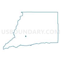
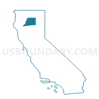
Voting District 10010, Shasta County, California
About
Outline

Summary
| Unique Area Identifier | 544280 |
| Name | Voting District 10010 |
| County | Shasta County |
| State | California |
| Area (square miles) | 1.48 |
| Land Area (square miles) | 1.46 |
| Water Area (square miles) | 0.01 |
| % of Land Area | 99.02 |
| % of Water Area | 0.98 |
| Latitude of the Internal Point | 40.60249650 |
| Longtitude of the Internal Point | -122.35214580 |
Maps

Graphs
Select a template below for downloading or customizing gragh for Voting District 10010, Shasta County, California


Neighbors
Neighoring Voting District (by Name) Neighboring Voting District on the Map
- Voting District 10005, Shasta County, CA
- Voting District 10020, Shasta County, CA
- Voting District 10025, Shasta County, CA
- Voting District 10035, Shasta County, CA
- Voting District 10050, Shasta County, CA
- Voting District 40310, Shasta County, CA
- Voting District 40340, Shasta County, CA
- Voting District 40350, Shasta County, CA
- Voting District 40355, Shasta County, CA
Top 10 Neighboring County Subdivision (by Population) Neighboring County Subdivision on the Map
Top 10 Neighboring Place (by Population) Neighboring Place on the Map
Top 10 Neighboring Elementary School District (by Population) Neighboring Elementary School District on the Map
- Redding Elementary School District, CA (34,977)
- Enterprise Elementary School District, CA (32,136)
- Columbia Elementary School District, CA (9,759)
Top 10 Neighboring Secondary School District (by Population) Neighboring Secondary School District on the Map
Top 10 Neighboring Unified School District (by Population) Neighboring Unified School District on the Map
Top 10 Neighboring State Legislative District Lower Chamber (by Population) Neighboring State Legislative District Lower Chamber on the Map
Top 10 Neighboring State Legislative District Upper Chamber (by Population) Neighboring State Legislative District Upper Chamber on the Map
Top 10 Neighboring 111th Congressional District (by Population) Neighboring 111th Congressional District on the Map
Top 10 Neighboring Census Tract (by Population) Neighboring Census Tract on the Map
- Census Tract 108.05, Shasta County, CA (5,006)
- Census Tract 108.03, Shasta County, CA (4,908)
- Census Tract 108.07, Shasta County, CA (4,362)
- Census Tract 107.03, Shasta County, CA (3,240)
- Census Tract 108.06, Shasta County, CA (3,192)
- Census Tract 108.04, Shasta County, CA (2,745)